Maroon Sailor Posted July 31, 2018 Author Share Posted July 31, 2018 4 minutes ago, parisjambo said: Calder Road? Yeah the original Calder Road before the Dual Carriageway Quote Link to comment Share on other sites More sharing options...
¼½¾ Posted July 31, 2018 Share Posted July 31, 2018 21 minutes ago, Maroon Sailor said: 8 minutes ago, parisjambo said: Calder Road? Here's one with the garage, to give you an idea of where it was. Quote Link to comment Share on other sites More sharing options...
Morgan Posted July 31, 2018 Share Posted July 31, 2018 4 hours ago, The Real Maroonblood said: I remember that. We called them buckies. Aye, buckies to me too. Ate them with a wee pin Quote Link to comment Share on other sites More sharing options...
NANOJAMBO Posted July 31, 2018 Share Posted July 31, 2018 54 minutes ago, Maroon Sailor said: Went past that little island today on Ferry Road / Goldenacre - they've narrowed the road by it. Must be a reason for keeping it as it's not serving much purpose now by the look of it. RBS is something else now as well It's now the Herringbone boozer. I'm still amazed that roundabout thing is still there and that no one has taken it out by now. Quote Link to comment Share on other sites More sharing options...
NANOJAMBO Posted July 31, 2018 Share Posted July 31, 2018 42 minutes ago, Maroon Sailor said: One of my fav parts of the city, down to the left and walk along the river to Stockbridge. I used to have a mate who lived just past the church on the same side. Great memories. Loving this thread. Quote Link to comment Share on other sites More sharing options...
NANOJAMBO Posted July 31, 2018 Share Posted July 31, 2018 14 hours ago, beardbeer said: Picture of Portobello open air pool and to the right was a 20'000 capacity (terraced) ground used for football amongst other things in the 1910s I think https://en.wikipedia.org/wiki/Marine_Gardens Quote Link to comment Share on other sites More sharing options...
Morgan Posted July 31, 2018 Share Posted July 31, 2018 20 hours ago, Stuart Lyon said: Wonderful, wonderful Quote Link to comment Share on other sites More sharing options...
Radio Ga Ga Posted July 31, 2018 Share Posted July 31, 2018 1 hour ago, Maroon Sailor said: They had a car wash where you enetered it through Sighthill Loan (next to Sighthill Bowling Club) and exited onto Calder Road through the garage Quote Link to comment Share on other sites More sharing options...
Radio Ga Ga Posted July 31, 2018 Share Posted July 31, 2018 1 hour ago, Lemongrab said: Here's one with the garage, to give you an idea of where it was. Can remember clearly the dualing being done, used to collect the empty lemonade bottles from the workies and cash them in for sweeties Quote Link to comment Share on other sites More sharing options...
been here before Posted July 31, 2018 Share Posted July 31, 2018 1 hour ago, Maroon Sailor said: Thats Longstone Road, the road in the background heading up toward the roundabout on the Calder Road. Quote Link to comment Share on other sites More sharing options...
been here before Posted July 31, 2018 Share Posted July 31, 2018 Whats happening here... Quote Link to comment Share on other sites More sharing options...
Sydney Posted July 31, 2018 Share Posted July 31, 2018 4 minutes ago, been here before said: Whats happening here... Something to do with WW2 and Luftwaffe attacks? Quote Link to comment Share on other sites More sharing options...
Sharpie Posted July 31, 2018 Share Posted July 31, 2018 5 hours ago, The Real Maroonblood said: I remember that. We called them buckies. I actually couldn't remember what they were called and thought of the song cockles and mussels alive alive o'. You are so correct thanks. Just a different wee comment, you have ruined a lifelong dream, I always thought because my boss who owned the garage and who drove all the way to the Hillburn from his home in Montpelier would have to be going to somewhere classy. Now I find it was just a pub and he had nae class at a'. Quote Link to comment Share on other sites More sharing options...
The Real Maroonblood Posted July 31, 2018 Share Posted July 31, 2018 1 hour ago, bobsharp said: I actually couldn't remember what they were called and thought of the song cockles and mussels alive alive o'. You are so correct thanks. Just a different wee comment, you have ruined a lifelong dream, I always thought because my boss who owned the garage and who drove all the way to the Hillburn from his home in Montpelier would have to be going to somewhere classy. Now I find it was just a pub and he had nae class at a'. Sorry Bob to shatter the dream. Quote Link to comment Share on other sites More sharing options...
¼½¾ Posted July 31, 2018 Share Posted July 31, 2018 1 hour ago, been here before said: Whats happening here... 1 hour ago, Sydney said: Something to do with WW2 and Luftwaffe attacks? First bombing raid on Britain in WW2. http://www.culture24.org.uk/history-and-heritage/military-history/world-war-two/art514798-forth-bridge-raid-the-first-luftwaffe-bombing-raid-of-world-war-two-remembered-at-queensferry-museum Quote Link to comment Share on other sites More sharing options...
Maroon Sailor Posted July 31, 2018 Author Share Posted July 31, 2018 (edited) 1 hour ago, been here before said: Thats Longstone Road, the road in the background heading up toward the roundabout on the Calder Road. I'm not sure where it is - if it is where you said it is the Longstone bus depot would be on the left Edited July 31, 2018 by Maroon Sailor Quote Link to comment Share on other sites More sharing options...
Maroon Sailor Posted July 31, 2018 Author Share Posted July 31, 2018 Portobello Funfair 1930's Quote Link to comment Share on other sites More sharing options...
Maroon Sailor Posted July 31, 2018 Author Share Posted July 31, 2018 Quote Link to comment Share on other sites More sharing options...
been here before Posted July 31, 2018 Share Posted July 31, 2018 (edited) 41 minutes ago, Maroon Sailor said: I'm not sure where it is - if it is where you said it is the Longstone bus depot would be on the left Its 100% Longstone Road... http://www.edinphoto.org.uk/0_street_l/0_street_views_-_longstone_road_bus_and_lamp_post_accident_1956.htm The bus garage when it first opened in the 50s was far smaller than it is now and sat mostly on Murrayburn Road. But most convincingly its a few doors along from where I used to stay. The front garden of No 6 I reckon. The bus stop is still there. Edited July 31, 2018 by been here before Quote Link to comment Share on other sites More sharing options...
Stuart Lyon Posted July 31, 2018 Share Posted July 31, 2018 9 minutes ago, Maroon Sailor said: Moir's Bar - good photo. Quote Link to comment Share on other sites More sharing options...
Maroon Sailor Posted July 31, 2018 Author Share Posted July 31, 2018 6 minutes ago, been here before said: Its 100% Longstone Road... http://www.edinphoto.org.uk/0_street_l/0_street_views_-_longstone_road_bus_and_lamp_post_accident_1956.htm The bus garage when it first opened in the 50s was far smaller than it is now and sat mostly on Murrayburn Road. But most convincingly its a few doors along from where I used to stay. The front garden of No 6 I reckon. The bus stop is still there. Didn't realise the 21 went along Longstone. Interesting the link when opened says Inverleith Row in the URL Quote Link to comment Share on other sites More sharing options...
Maroon Sailor Posted July 31, 2018 Author Share Posted July 31, 2018 16 minutes ago, been here before said: Its 100% Longstone Road... http://www.edinphoto.org.uk/0_street_l/0_street_views_-_longstone_road_bus_and_lamp_post_accident_1956.htm The bus garage when it first opened in the 50s was far smaller than it is now and sat mostly on Murrayburn Road. But most convincingly its a few doors along from where I used to stay. The front garden of No 6 I reckon. The bus stop is still there. Just so I'm clear here, how far down the road is it ? Would the roundabout now be this side of the bus or was that built later than this phot and put in behind the bus. I've got the Parkhead houses (under the wing mirror) that go along Murrayburn Road. Quote Link to comment Share on other sites More sharing options...
been here before Posted July 31, 2018 Share Posted July 31, 2018 (edited) 20 minutes ago, Maroon Sailor said: Just so I'm clear here, how far down the road is it ? Would the roundabout now be this side of the bus or was that built later than this phot and put in behind the bus. I've got the Parkhead houses (under the wing mirror) that go along Murrayburn Road. Aye the Parkhead houses where you say. The pick up lorry is about where Longstone Cresent is. The roundabout is by the big building on the right which was an NHS bulding- The Longstone Clinic, which is still there. Why there is a 21 there Ive no idea- leaving the garage perhaps. Ive got no idea where a 21 goes now let alone 60 years ago. I will be truly gobsmaked if thats anywhere else. Mind you Ive been wrong before, but not here. Surely... I could take you to the very spot in the front garden its taken from!!... I think.... Edited July 31, 2018 by been here before Quote Link to comment Share on other sites More sharing options...
SUTOL Posted July 31, 2018 Share Posted July 31, 2018 (edited) Looks to be about the Parkhead Loan junction. https://goo.gl/maps/DUhkHpGpM1F2 Edited July 31, 2018 by SUTOL changed link Quote Link to comment Share on other sites More sharing options...
been here before Posted July 31, 2018 Share Posted July 31, 2018 2 minutes ago, SUTOL said: Looks to be about the Parkhead Loan junction. https://goo.gl/maps/b1WDdJWAtpQ2 Parkhead Loan junction- where I also once lived would be roughly where those 2 figures are in the distance crossing the road but a bit further up. Quote Link to comment Share on other sites More sharing options...
SUTOL Posted July 31, 2018 Share Posted July 31, 2018 1 hour ago, been here before said: Parkhead Loan junction- where I also once lived would be roughly where those 2 figures are in the distance crossing the road but a bit further up. I think you may be mistaken. The image in my link shows the same landmarks in the same positions as the crash picture. i.e. the square flat roofed tower at the bus depot is next to the taller building on the right of the road. Quote Link to comment Share on other sites More sharing options...
Maroon Sailor Posted July 31, 2018 Author Share Posted July 31, 2018 (edited) 17 minutes ago, SUTOL said: I think you may be mistaken. The image in my link shows the same landmarks in the same positions as the crash picture. i.e. the square flat roofed tower at the bus depot is next to the taller building on the right of the road. I think you might be right It's looking towards where the roundabout is now and that bus at the top of the picture in the distance is heading towards the Longstone Inn Also makes sense the 21 bus was coming out of the depot to take up it's route Broomhouse / Clermiston Edited July 31, 2018 by Maroon Sailor Quote Link to comment Share on other sites More sharing options...
been here before Posted July 31, 2018 Share Posted July 31, 2018 21 minutes ago, SUTOL said: I think you may be mistaken. The image in my link shows the same landmarks in the same positions as the crash picture. i.e. the square flat roofed tower at the bus depot is next to the taller building on the right of the road. Do you know what, you might well be right. The 2 views from either side of the roundabout are remarkably similar. My gob is well and truly smacked. I would have sworn blind that was in the garden outside no4. Im still not wholly convinced mind... Ive tried to get screenshots from either side of where the roundabout now lives but cant get the same perspective so it looks a bit shite! I thought the road in the background was going uphill which made me think it was going toward the Calder Road, also it turns left then right in an S shape as it does that was the clincher. Its like a morror image if you look from the other side of the roundabout. You could well be on the button though. Quote Link to comment Share on other sites More sharing options...
JudyJudyJudy Posted July 31, 2018 Share Posted July 31, 2018 2 hours ago, been here before said: Aye the Parkhead houses where you say. The pick up lorry is about where Longstone Cresent is. The roundabout is by the big building on the right which was an NHS bulding- The Longstone Clinic, which is still there. Why there is a 21 there Ive no idea- leaving the garage perhaps. Ive got no idea where a 21 goes now let alone 60 years ago. I will be truly gobsmaked if thats anywhere else. Mind you Ive been wrong before, but not here. Surely... I could take you to the very spot in the front garden its taken from!!... I think.... 21 used to end up at Greendykes terminus...cant remember where is end location was the other way??? Quote Link to comment Share on other sites More sharing options...
Maroon Sailor Posted July 31, 2018 Author Share Posted July 31, 2018 14 minutes ago, JamesM48 said: 21 used to end up at Greendykes terminus...cant remember where is end location was the other way??? Broomhouse Quote Link to comment Share on other sites More sharing options...
¼½¾ Posted July 31, 2018 Share Posted July 31, 2018 23 minutes ago, been here before said: Do you know what, you might well be right. The 2 views from either side of the roundabout are remarkably similar. My gob is well and truly smacked. I would have sworn blind that was in the garden outside no4. Im still not wholly convinced mind... Ive tried to get screenshots from either side of where the roundabout now lives but cant get the same perspective so it looks a bit shite! I thought the road in the background was going uphill which made me think it was going toward the Calder Road, also it turns left then right in an S shape as it does that was the clincher. Its like a morror image if you look from the other side of the roundabout. You could well be on the button though. The roof structures, to the just to the left of the bus garage tower in your second pic, look pretty much the same as in the old picture. Quote Link to comment Share on other sites More sharing options...
Maroon Sailor Posted July 31, 2018 Author Share Posted July 31, 2018 Not sure of this one Quote Link to comment Share on other sites More sharing options...
Maroon Sailor Posted July 31, 2018 Author Share Posted July 31, 2018 Or this one Quote Link to comment Share on other sites More sharing options...
Maroon Sailor Posted July 31, 2018 Author Share Posted July 31, 2018 Quote Link to comment Share on other sites More sharing options...
Stuart Lyon Posted July 31, 2018 Share Posted July 31, 2018 14 minutes ago, Maroon Sailor said: Canonmills Quote Link to comment Share on other sites More sharing options...
FORTHCLYDE Posted July 31, 2018 Share Posted July 31, 2018 14 minutes ago, Maroon Sailor said: Brandon Street Canonmills Quote Link to comment Share on other sites More sharing options...
been here before Posted July 31, 2018 Share Posted July 31, 2018 13 minutes ago, Maroon Sailor said: Canonmills? Quote Link to comment Share on other sites More sharing options...
Maroon Sailor Posted July 31, 2018 Author Share Posted July 31, 2018 Canonmills was the easy one - any ideas on the other 2 cos I ain't got a scooby Quote Link to comment Share on other sites More sharing options...
¼½¾ Posted July 31, 2018 Share Posted July 31, 2018 32 minutes ago, Maroon Sailor said: Or this one Pinterest says that one's Colinton Road. Quote Link to comment Share on other sites More sharing options...
been here before Posted July 31, 2018 Share Posted July 31, 2018 35 minutes ago, Maroon Sailor said: Not sure of this one 1 minute ago, Lemongrab said: Pinterest says that one's Colinton Road. Funny that I thought the above one was Colinton Road Quote Link to comment Share on other sites More sharing options...
¼½¾ Posted July 31, 2018 Share Posted July 31, 2018 (edited) 4 minutes ago, been here before said: Funny that I thought the above one was Colinton Road It may well be. It's one heck of a long road. Also, both trams are on the same route, 9. Edited July 31, 2018 by Lemongrab Quote Link to comment Share on other sites More sharing options...
¼½¾ Posted July 31, 2018 Share Posted July 31, 2018 1 hour ago, Maroon Sailor said: Not sure of this one I don't have a clue about the other one, the wall might not even be there now and there's little else to go on. This one though, here's a pic of one of three houses on the right when leaving Colinton Village, heading into town. Could one of these be the house on the right? Quote Link to comment Share on other sites More sharing options...
Maroon Sailor Posted July 31, 2018 Author Share Posted July 31, 2018 (edited) 22 minutes ago, Lemongrab said: I don't have a clue about the other one, the wall might not even be there now and there's little else to go on. This one though, here's a pic of one of three houses on the right when leaving Colinton Village, heading into town. Could one of these be the house on the right? Could be In between Thorburn Road and Redford Road There is a cottage called Heather Cottage on that road (left out the village) but it could be blocked out by the tram. Might have been a big clue Edited July 31, 2018 by Maroon Sailor Quote Link to comment Share on other sites More sharing options...
Maroon Sailor Posted July 31, 2018 Author Share Posted July 31, 2018 End of the line for this tram - can't go any further Quote Link to comment Share on other sites More sharing options...
Maroon Sailor Posted July 31, 2018 Author Share Posted July 31, 2018 Granton Road Station - never knew it existed let alone where it was Quote Link to comment Share on other sites More sharing options...
SUTOL Posted July 31, 2018 Share Posted July 31, 2018 1 hour ago, Maroon Sailor said: Could be In between Thorburn Road and Redford Road There is a cottage called Heather Cottage on that road (left out the village) but it could be blocked out by the tram. Might have been a big clue That's where I thought it looked like on first looking at it. And after checking an old map it shows the tram line finishing just about there, outside the garage. And that looks like the end of the tram line in the photo. Quote Link to comment Share on other sites More sharing options...
SUTOL Posted July 31, 2018 Share Posted July 31, 2018 3 hours ago, Maroon Sailor said: Or this one I'm thinking maybe Craiglockhart area. The hill looks a reasonable slope, but not sure bout the coach, where it has come from. What time-frame do think for the photo? Quote Link to comment Share on other sites More sharing options...
luckyBatistuta Posted July 31, 2018 Share Posted July 31, 2018 1 hour ago, Maroon Sailor said: End of the line for this tram - can't go any further Looks like Craigleith road Quote Link to comment Share on other sites More sharing options...
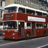
¼½¾ Posted July 31, 2018 Share Posted July 31, 2018 1 hour ago, luckyBatistuta said: Looks like Craigleith road Yup, that's where the 24 terminated. Quote Link to comment Share on other sites More sharing options...
luckyBatistuta Posted July 31, 2018 Share Posted July 31, 2018 6 minutes ago, Lemongrab said: Yup, that's where the 24 terminated. Crazy place to end it. You’d think it would have at least run to the end of the road. Maybe it stopped there, because it’s outside the hospital. Quote Link to comment Share on other sites More sharing options...

Recommended Posts
Join the conversation
You can post now and register later. If you have an account, sign in now to post with your account.